

State Profile
State Profile of Bihar
Bihar is located in the eastern part of India (between 24°-20'-10" to 27°-31'-15" N latitude and 83°-19'-50" to 88°-17'-40" E longitude). It is an entirely land-locked state, mid-way between the humid West Bengal in the east and sub-humid Uttar Pradesh in the west. The Bihar plain is divided into two unequal halves by the river Ganga which flows through the middle from west to east.
State Capital
Patna
Total Area
94,163 sq km
Official Language
Hindi & Urdu
Formation
22 March 1912
Administrative Framework
9
Divisions
38
Districts
101
Sub-Divisions
534
CD Blocks
8,053
Panchayats
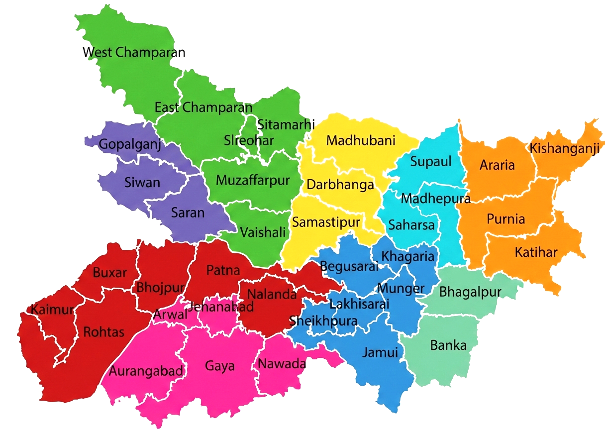
Administrative Divisions of Bihar
| Revenue Villages | 45,858 |
| Total Towns | 199 (139 Statutory + 60 Non-Statutory) |
| Police Stations | 853 (813 Civil + 40 Railway) |
| Police Districts | 40 Civil, 4 Railway |
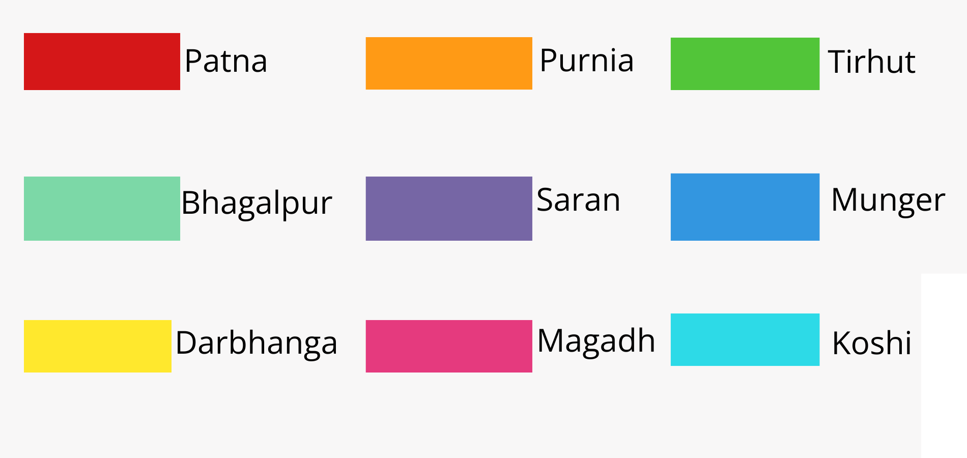
Bihar at a glance
Physical Features
| Latitude | 24° – 27° N |
| Longitude | 83° – 88° E |
| Rural Area | 92,257 sq km |
| Urban Area | 1,095 sq km |
| Avg. Height above Sea Level | 173 ft (53 m) |
| AAvg. Rainy Days/Year | 52.5 days |
2011 Census Highlights
| Population Density | 1,106 / sq km |
| Highest Density | Sheohar – 1,880 / sq km |
| Lowest Density | Kaimur – 488 / sq km |
| Most Populous District | Patna – 5,838,465 |
| Least Populous District | Sheikhpura – 636,342 |
| Sex Ratio | 918 females / 1,000 males |
| Highest Sex Ratio | Gopalganj – 1,021 |
| Highest Literacy | Rohtas – 73.37% |
| Lowest Literacy | Purnia – 51.08% |